LiDAR portatile Sphere360: la vostra guida alla mappatura di precisione
22 January 2026
Professionals in surveying and digital twin creation face big accuracy challenges. These issues often arise in GNSS-denied spaces like underground sites and dense cities. Conventional tools usually need external help, which slows down work. The Sphere360 Handheld LiDAR Scanner fixes this problem with multi-mode SLAM fusion. It achieves ≤5cm absolute accuracy even in low-light or overgrown areas. Moreover, this blog explores its unique benefits, backed by real case studies. It also includes a step-by-step decision guide to take you from awareness to adoption.
Why Handheld LiDAR is Revolutionizing Surveying
The LiDAR market is growing at 15.2% CAGR (2025-2030). Driving this expansion is rising demand for digital twins. However, balancing accuracy and adaptability remains a key challenge. Traditional RTK-GNSS tools fail indoors or under heavy canopy cover. To overcome this, the Sphere360 uses RTK-SLAM and pure SLAM technology. It delivers consistent ≤3cm relative accuracy in tough conditions. For example, a European utility company scanned a 10km power line in just 2 hours. Previously, this task took 5 hours with old methods—cutting costs by 40%. Additionally, its fusion of LiDAR, GNSS, and INS ensures reliability in scenarios like:
Urban surveying: As-built modeling with ≤3cm deviation.
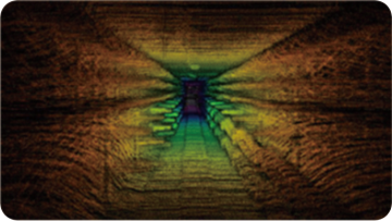
Infrastructure inspection: Sub-centimeter crack detection.
Digital twins: Real-time 3D modeling for AR/VR.
This shift emphasizes workflow efficiency, as end-to-end solutions become essential.
Key Features: Beyond the Specs
At its core, the Sphere360 uses the Livox Mid-360 LiDAR. Complementing this are dual 20MP fish-eye cameras for true-color point clouds. These features capture 200,000 points per second. But its most standout trait is portability—weighing only 1.0kg. Measuring 16.5×12.0x32.4cm, it fits easily in one hand. Adding to its convenience is a hot-swappable battery for non-stop use.
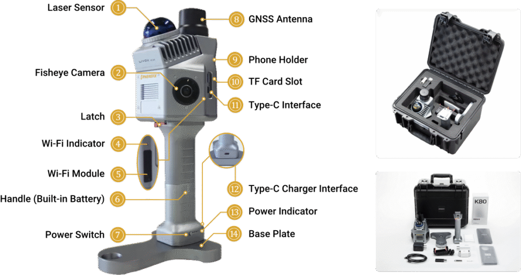
This design enables grab-and-go operation, consuming less than 25W of power. It works reliably from -20°C to 55°C, handling extreme environments. Furthermore, the integrated PointFlow software allows on-device preprocessing. The Point Cloud Automata platform automates classification, cutting processing time by 50% in tests.
Key Technical Specs
- Laser: 40m range at 10% reflectivity, 1535nm wavelength.
- Cameras: 200° FOV for synchronized colorization.
- Storage: 64GB internal + 128GB MicroSD.
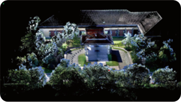
In a Romanian case study, the Sphere360 achieved 98% model accuracy. It scanned a historical building with impressive results, showcasing its versatility.
Decision-Making Guide: From Consideration to Purchase
Choosing a LiDAR scanner means balancing accuracy, portability, and cost. Follow these steps to make the right choice:
Step 1: Assess Your Needs
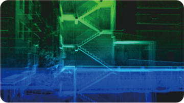
- Indoor mapping (e.g., stairs): Prioritize SLAM mode and lightweight design.
- Outdoor with GNSS: Opt for RTK-SLAM for faster, more precise results.
- Color requirements: Dual cameras are essential for detailed texture capture.
Step 2: Evaluate Metrics
- Accuracy: Sphere360’s ≤5cm error beats entry-level models (10-15cm).
- Battery: ~4 hours per charge; plan for swaps in long surveys.
- Workflow: Ensure compatibility with common exports like LAS/PLY.
Step 3: Test and Integrate
- Start small: Scan a known area (e.g., 10m corridor) to validate performance.
- Leverage Wi-Fi: Enable real-time data transfer for instant analysis.
- Pro tip: Pair with Spherefix software for automated feature extraction.
This approach avoids pitfalls like under-sampling. Notably, a Moroccan project used this method to streamline parking lot mapping. The Sphere360 delivered fast, accurate results with minimal hassle.
Conclusion: Is the Sphere360 Right for You?
The Sphere360 offers a complete solution for precision mapping. Its lightweight design, fusion technology, and seamless processing stand out. As industries embrace digitalization, it future-proofs operations against evolving challenges. Have you used handheld LiDAR before? Share your experiences below! For more information, please contact Spherefix.
Based on Sphere360 specifications and 2025 industry data. Verify parameters with manufacturers.