Unbemanntes Vermessungsboot & Hydrographische Vermessung USV--Spherefix Marine Vermessungslösungen für globale Gewässer
15. März 2026
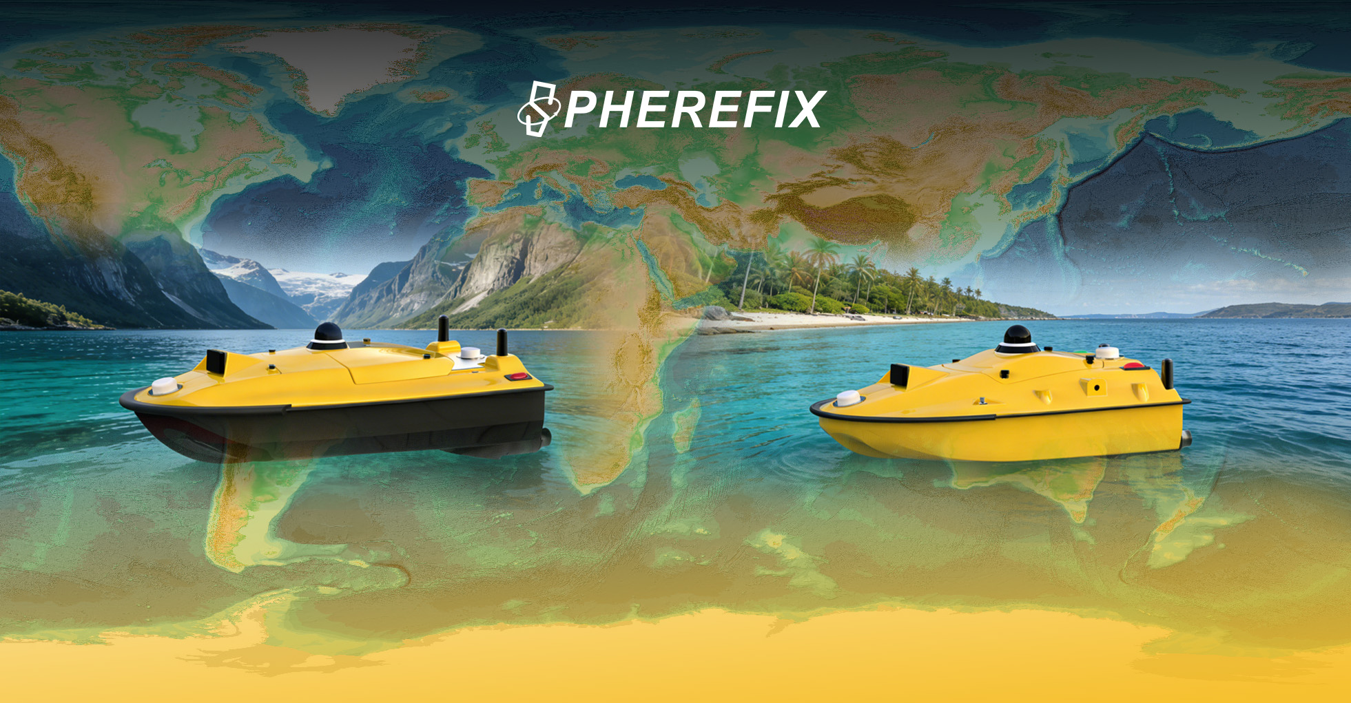
Neue Wege in der hydrografischen Vermessung: Unbemanntes Vermessungsboot und USV von Spherefix definieren die globale Meereskartierung neu
In der weltweiten Seevermessungsbranche ist die Nachfrage nach effizienten und sicheren hydrographischen Kartierungen stark angestiegen. Unbemanntes Vermessungsboot und Hydrographische Vermessung USV Technologien haben sich als bahnbrechende Lösungen für seit langem bestehende Schwächen der Branche erwiesen. Herkömmliche hydrographische Vermessungsmethoden werden seit langem von hartnäckigen Problemen geplagt, die die betriebliche Effizienz behindern, die Sicherheit gefährden und die geografische Abdeckung einschränken, so dass große Teile der globalen Gewässer nicht vermessen werden. Herkömmliche bemannte Vermessungsschiffe haben mit geringer Arbeitseffizienz, langen Projektzyklen und exorbitanten Betriebskosten zu kämpfen, während die Besatzungen vor Ort in turbulenten Gewässern, engen Flachwasserzonen und gefährlichen Küstengebieten mit erheblichen Sicherheitsrisiken konfrontiert sind. Noch schlimmer ist, dass viele große bemannte Schiffe keinen Zugang zu flachen Buchten, Wattgebieten und schmalen Binnengewässern haben, so dass wichtige maritime topografische Daten nicht erfasst werden und Lücken in der globalen hydrographischen Vermessung entstehen. In dieser Situation hat sich die unbemannte Meeresvermessungstechnologie als globaler Trend etabliert und ersetzt manuelle Eingriffe durch autonome Systeme, die eine sicherere, schnellere und präzisere hydrografische Vermessung ermöglichen. Als führender Anbieter fortschrittlicher Meeresvermessungslösungen schließt Spherefix Navigation Technology diese Lücke mit seiner innovativen Produktreihe unbemannter Vermessungsboote und hydrographischer Vermessungs-USVs, die entwickelt wurden, um die Herausforderungen der globalen Meeresvermessung zu meistern und die Maßstäbe der Branche für hochwertige hydrographische Vermessungsgeräte neu zu definieren.
Hauptstärken des unbemannten Vermessungsbootes Spherefix: Erstklassige hydrographische Vermessungsausrüstung für globale maritime Anpassungsfähigkeit
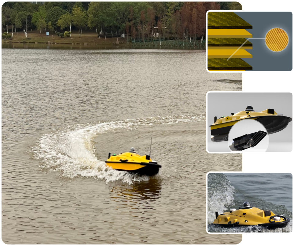
Das Flaggschiff von Spherefix Unbemanntes Vermessungsboot Modelle - SPCraft6 und SPCraft5 - sind eigens für die hydrographische Vermessung entwickelte Hochleistungsgeräte, die für den Einsatz in verschiedenen globalen Wasserumgebungen - von europäischen und amerikanischen Küstengewässern bis hin zu asiatisch-pazifischen Binnenseen und lateinamerikanischen Wattenmeeren - konzipiert wurden und die Betriebsbeschränkungen veralteter herkömmlicher Vermessungsgeräte vollständig beseitigen. Diese unbemannten Schiffe sind mit robusten, leistungsstarken Verbundstoffrümpfen ausgestattet und verfügen über eine außergewöhnliche Wellenfestigkeit. Sie können Windstärken der Stufe 3 und Wellen der Stufe 2 standhalten und gewährleisten einen stabilen Betrieb unter rauen hydrologischen Bedingungen, so dass eine ununterbrochene hydrographische Vermessung auch in anspruchsvollen Offshore- und Küstengebieten gewährleistet ist.
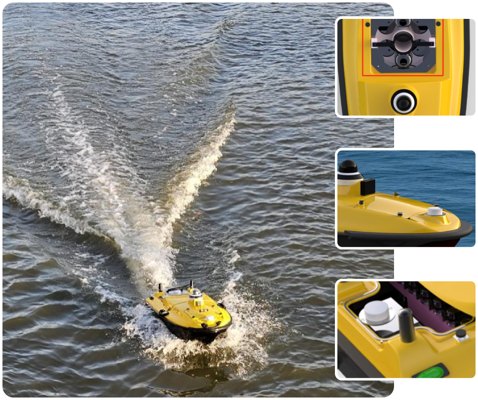
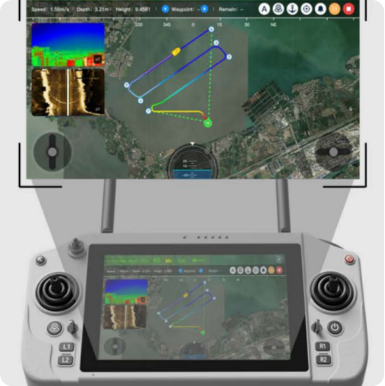
Das SPCraft6, ein professionelles unbemanntes Überwasserfahrzeug, verfügt über einen 1,3 Meter langen, hochfesten Verbundwerkstoffrumpf aus makromolekularem Polyester, Kohlefaser und Kevlar mit kompakten Abmessungen von 1280×580×430 mm, einem Eigengewicht von 12 kg und einer beeindruckenden maximalen Nutzlastkapazität von 50 kg. Dieses robuste Design unterstützt die nahtlose Integration fortschrittlicher Vermessungsnutzlasten wie Fächerecholot, ADCP und Wasserqualitätssensoren und fungiert als mobiles Labor auf dem Wasser für eine umfassende hydrographische Datenerfassung. In Verbindung mit der von Spherefix selbst entwickelten intelligenten Steuerungsplattform iSail ermöglicht das Schiff vollständig autonome Arbeitsabläufe: von der Missionsplanung mit einem Klick über die autonome Navigation bis hin zur Datenerfassung und Nachbearbeitung in Echtzeit, wodurch manuelle Eingriffe entfallen und die betriebliche Effizienz exponentiell gesteigert wird.
Das kompakte SPCraft5, das komplett montiert nur 30 kg wiegt, verfügt über einen stromlinienförmigen, vollständig gewölbten Rumpf aus hochfestem Polymer-Verbundwerkstoff mit Wasserdichtigkeit nach IP67, der sofort einsatzbereit ist und keine Montage vor Ort erfordert. Seine Nutzlastkapazität von 35 kg unterstützt Echolote, Side-Scan-Sonar und LiDAR-Integration und ist damit ideal für Vermessungen in flachen Gewässern und Binnengewässern. Beide Modelle verfügen über ein intelligentes Radar zur Hindernisvermeidung (0,1-20 m Erfassungsbereich, optionale 40-m-Version), Funktionen zur automatischen Rückkehr bei niedrigem Batteriestand und Signalverlust sowie eine Panorama-Nachtsicht, die ein mehrschichtiges Sicherheitssystem zum Schutz der Ausrüstung und zur Gewährleistung eines zuverlässigen Betriebs in globalen Meeresszenarien bieten.
Hydrographische Vermessung USV: Unübertroffene technische Vorteile der hydrographischen Vermessungsausrüstung von Spherefix

Als Top-Tier Hydrographische Vermessung USV Lösung heben sich die unbemannten Vermessungsschiffe von Spherefix von herkömmlichen, wenig effizienten hydrographischen Vermessungsgeräten durch branchenführende Präzision, schnelle Einsatzfähigkeit und flexible Anpassungsfähigkeit an globale Wasserumgebungen ab. Das Herzstück der Präzisionsleistung ist das integrierte GNSS-RTK-Positionierungssystem mit zwei Antennen, das Signale aus mehreren Konstellationen (BDS, GPS, GLONASS, Galileo) unterstützt und eine außergewöhnliche RTK-Positionierungsgenauigkeit bietet: horizontal 8 mm +1ppm, vertikal 15 mm +1ppm, was hydrographische Daten auf Zentimeter-Ebene gewährleistet, die die Genauigkeit herkömmlicher manueller Vermessungsmethoden und veralteter Vermessungsgeräte weit übertreffen.
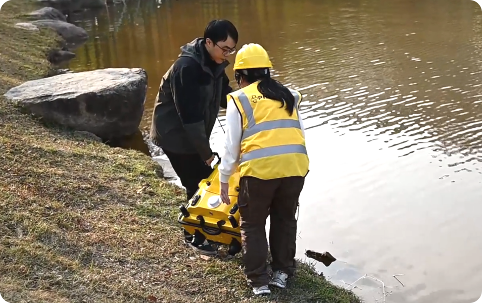
Das leichte und tragbare Design ist ein weiterer entscheidender Vorteil dieses hydrographischen Vermessungs-USVs, das die Probleme mit sperrigen, schwer zu verteilenden herkömmlichen hydrographischen Vermessungsgeräten direkt angeht. Der 12 kg schwere Rumpf des SPCraft6 und der 7 kg schwere Rumpf des SPCraft5 ermöglichen einen einfachen Transport und einen schnellen Einsatz vor Ort, wobei im laufenden Betrieb austauschbare Lithiumbatterien mit hoher Kapazität für eine längere Lebensdauer sorgen: SPCraft6 bietet bis zu 5 Stunden Betriebszeit bei 1,5 m/s (38 km ökonomische Reichweite), während SPCraft5 bis zu 7 Stunden bei der gleichen Geschwindigkeit bietet, was die hydrographische Vermessung in einem Einsatz maximiert. Die Echtzeit-Datenübertragung über 4G/2.4G/UHF-Multimodus-Kommunikation gewährleistet eine nahtlose Datensynchronisation zwischen Schiff und Fernsteuerungsterminal mit unbegrenzter Reichweite über die 4G-Konnektivität, die sich perfekt für Langstrecken-Offshore- und überregionale hydrografische Vermessungsprojekte eignet. Die offene SDK-Schnittstelle unterstützt auch die sekundäre Entwicklung und ermöglicht benutzerdefinierte Funktionskonfigurationen, um die einzigartigen hydrographischen Vermessungsanforderungen verschiedener Regionen und Branchen weltweit zu erfüllen.
Globale Anwendungen in der realen Welt: Unbemanntes Vermessungsboot und hydrographisches Vermessungsgerät USV übertreffen herkömmliche Geräte
Spherefix Unbemanntes Vermessungsboot und Hydrographische Vermessung USV-zwei Grundpfeiler der erstklassigen hydrographischen Vermessungsausrüstung von Spherefix- sind auf den globalen Märkten weit verbreitet und haben in verschiedenen hydrographischen Vermessungsszenarien zu spürbaren Effizienzsteigerungen und operativen Durchbrüchen geführt, wobei sie die traditionellen bemannten Vermessungsmethoden und veraltete Ausrüstung bei weitem übertrafen.
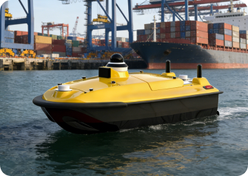
Unter Hydrographische Erhebungen in europäischen und amerikanischen Häfen, SPCraft6 hat die Messung der Hafentiefe und die Kartierung des Unterwassergeländes revolutioniert. Herkömmliche bemannte Schiffe benötigten 3 bis 5 Tage für eine mittelgroße Hafenvermessung, wobei die Sicherheit der Besatzung in stark befahrenen Hafengewässern gefährdet war und der Zugang zu flachen Anlegebereichen eingeschränkt war. Das SPCraft6 erledigt den gleichen Vermessungsumfang in nur 8-12 Stunden, wobei der autonome Betrieb die Gefährdung der Besatzung ausschließt, das integrierte Fächerecholot flächendeckende Geländedaten erfasst und die Genauigkeit im Zentimeterbereich die Einhaltung der internationalen Hafenvermessungsstandards gewährleistet.
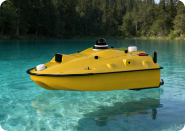
Für Hydrologische Überwachung von Binnenseen in Asien und im Pazifik, Das kompakte SPCraft5 eignet sich hervorragend für den Einsatz in engen, flachen Seen, in denen bemannte Schiffe nicht operieren können. Mit der Aufgabe, Wasserqualitätsproben zu nehmen, hydrologische Daten zu sammeln und die Topografie des Seebodens zu erfassen, erreicht das USV eine ununterbrochene Überwachung rund um die Uhr, was mit manuellen periodischen Probenahmen unmöglich ist. Die Datenübertragung in Echtzeit ermöglicht eine sofortige Analyse der Wasserqualität und der hydrologischen Veränderungen in den Seen, wodurch die Datenerfassungszyklen im Vergleich zu herkömmlichen Methoden um 70% verkürzt werden und zuverlässige Daten für den ökologischen Schutz der Seen und die Bewirtschaftung der Wasserressourcen zur Verfügung stehen.
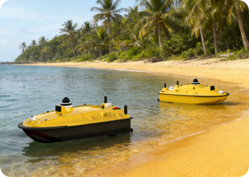
Unter Erkennung flacher Küstengebiete in Lateinamerika, Dank des geringen Tiefgangs (SPCraft6: 10 cm, SPCraft5: 8,5 cm) können beide Modelle in sehr flachen Watten und küstennahen Gewässern fahren, die für herkömmliche Vermessungsschiffe unzugänglich sind. Sie erfassen effizient topografische Küstendaten und unterstützen damit den Bau von Küstenanlagen und die Erschließung von Meeresressourcen. Die robusten Rümpfe aus Verbundwerkstoff sind korrosions- und verschleißbeständig in rauen Küstenumgebungen und gewährleisten einen langfristigen stabilen Betrieb in tropischen und subtropischen Küstengebieten.
Partnerschaft mit Spherefix: Verbessern Sie die globale hydrographische Vermessung mit erstklassiger hydrographischer Vermessungsausrüstung
Spherefix's Unbemanntes Vermessungsboot und Hydrographische Vermessung USV stehen für die Zukunft der effizienten, sicheren und präzisen Meeresvermessung und setzen neue Maßstäbe für leistungsstarke hydrographische Vermessungsgeräte in allen Gewässern der Welt. Ganz gleich, ob Sie hydrographische Offshore-Kartierungen, die Überwachung von Binnengewässern, die Erkennung von flachen Küstenabschnitten oder die Vermessung von Hafeninfrastrukturen durchführen, Spherefix bietet maßgeschneiderte, zuverlässige Lösungen, um betriebliche Grenzen zu überwinden und neue Maßstäbe für die Effizienz hydrographischer Vermessungen zu setzen.
Entdecken Sie die vollständigen technischen Spezifikationen von Spherefix Hydrographische Vermessung USV, Unbemanntes Vermessungsboot und die gesamte Palette der hydrographischen Vermessungsausrüstung durch einen Besuch www.spherefixgnss.com heute. Um die branchenführende Leistung aus erster Hand zu erleben, vereinbaren Sie eine Vor-Ort-Demonstration in Ihrer Region - unser globales Serviceteam ist bereit, Ihnen zu zeigen, wie die hochmoderne Meereskartierungstechnologie von Spherefix Ihre hydrografischen Vermessungsabläufe verändern kann. Nutzen Sie die Zukunft der Seevermessung mit Spherefix und navigieren Sie in globalen Gewässern mit unvergleichlicher Präzision und Effizienz.
Hinweis: Die Produktparameter unterliegen den letzten offiziellen Aktualisierungen. Für Anfragen wenden Sie sich bitte an contact@spherefixgnss.com oder besuchen Sie unsere offizielle Website für detaillierte Produktinformationen.
