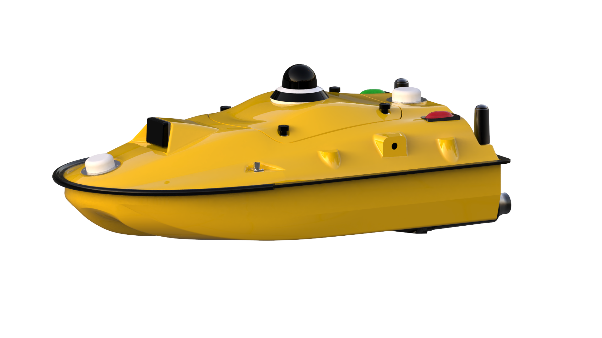
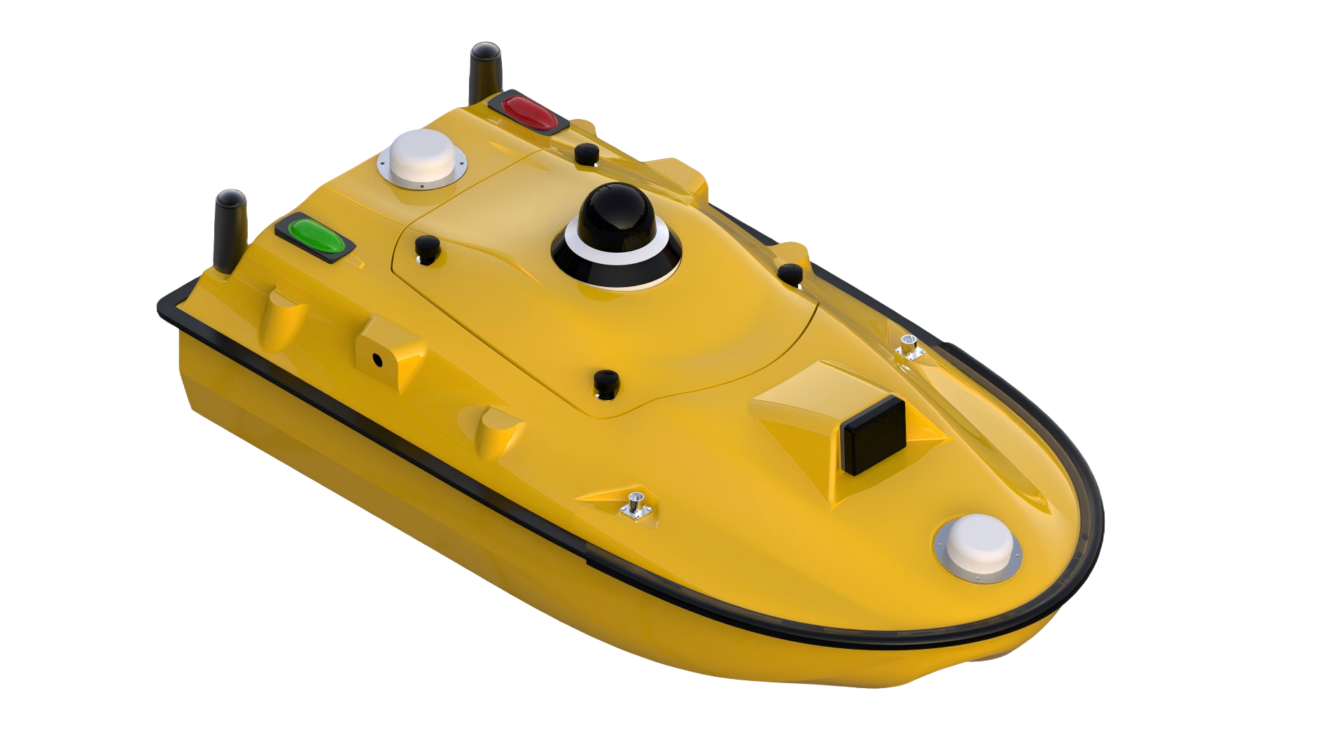
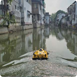
SPCraft5 Unbemanntes Überwasserfahrzeug (USV)
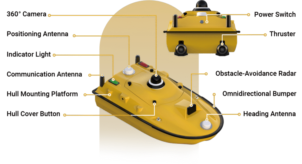
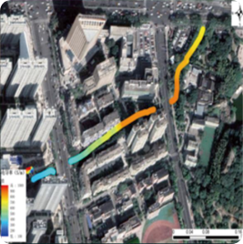
SPCraft5 ist ein multifunktionales unbemanntes Unterwasserfahrzeug (USV), das von Guangzhou Spherefix Navigation Technology Co. entwickelt wurde. Es wurde für die Unterwasservermessung, Patrouille und Aufklärung sowie die Überwachung der Wasserqualität entwickelt. Es verfügt über ein eigenes intelligentes Steuerungssystem und unterstützt Nutzlasten wie Echolote, Side-Scan-Sonare und Wasserqualitätssensoren. SPCraft5 arbeitet nahtlos mit iSail zusammen, um eine durchgängige Datenerfassung und -analyse zu ermöglichen. Damit bietet es eine sicherere, effizientere und präzisere Lösung für unterschiedliche Wasserumgebungen.
MERKMAL

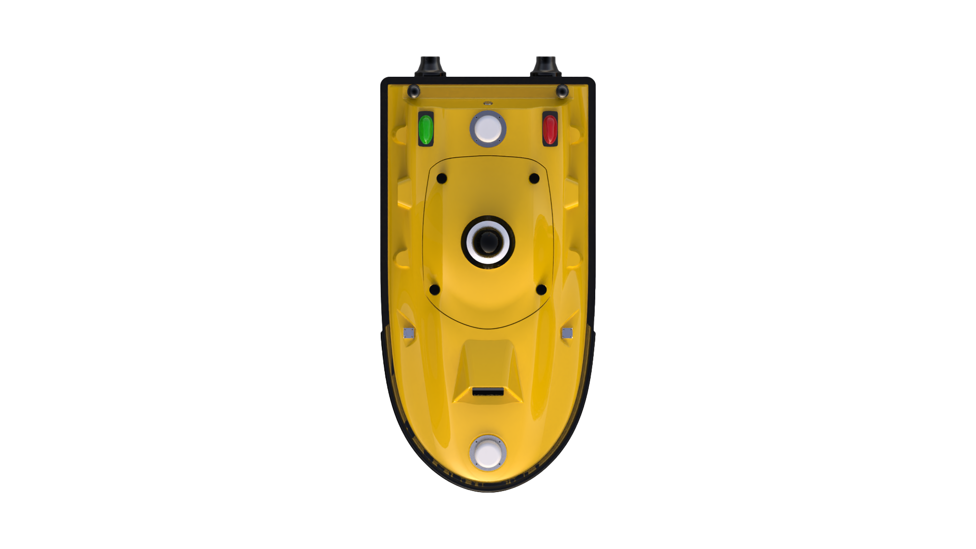
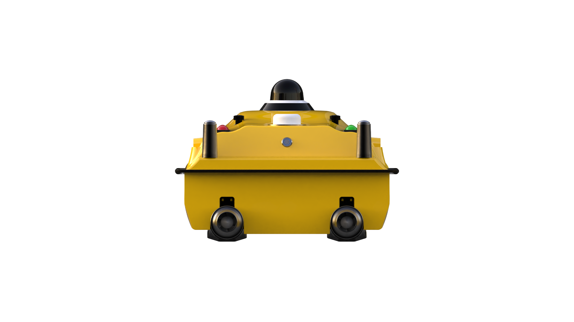
Integriertes tragbares Design

Hochpräzise intelligente Steuerung

Lange Ausdauer & kraftvoller Antrieb

Multifunktionale Erweiterungsmöglichkeiten
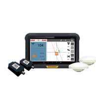
SYSTEMZUSAMMENSETZUNG
ANDERE EIGENSCHAFTEN

Zweifacher Schutz: omnidirektionale Stoßdämpfer mit Anti-Sink-Design.
Intelligente Sicherheit: Kollisionsvermeidung und automatische Rückwärtsfahrt in flachem Wasser.

7″-Controller: 1080P HD-Video, 3 km Reichweite (unbegrenzt über 4G).
Ausdauer der Fernbedienung: bis zu 8 Stunden.

PPK-Nachbearbeitung mit Lage- und Gezeitenkorrektur erhöht die Datengenauigkeit.
Die KI-Zielerkennung verbessert die Verarbeitungseffizienz.

Plug-and-Play-Antrieb und Hot-Swap-Akku für ununterbrochenen Betrieb.
Offene Schnittstellen ermöglichen eine flexible Nutzlastintegration und Sekundärentwicklung.
ANWENDUNGSSZENARIO
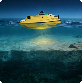
Wassertiefe Messung
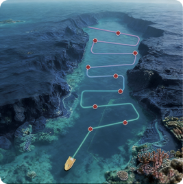
Wasserqualität Probenahme
Wasserqualität Überwachung
")
")