SPCraft6 Unmanned surface vessel(USV)
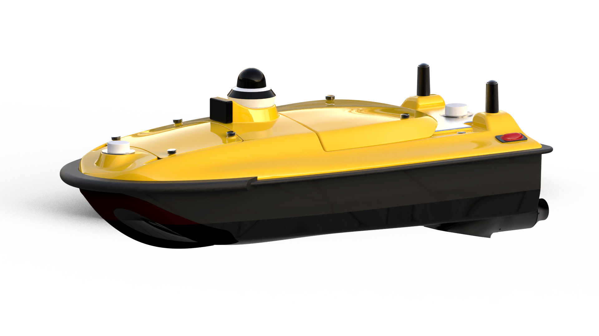
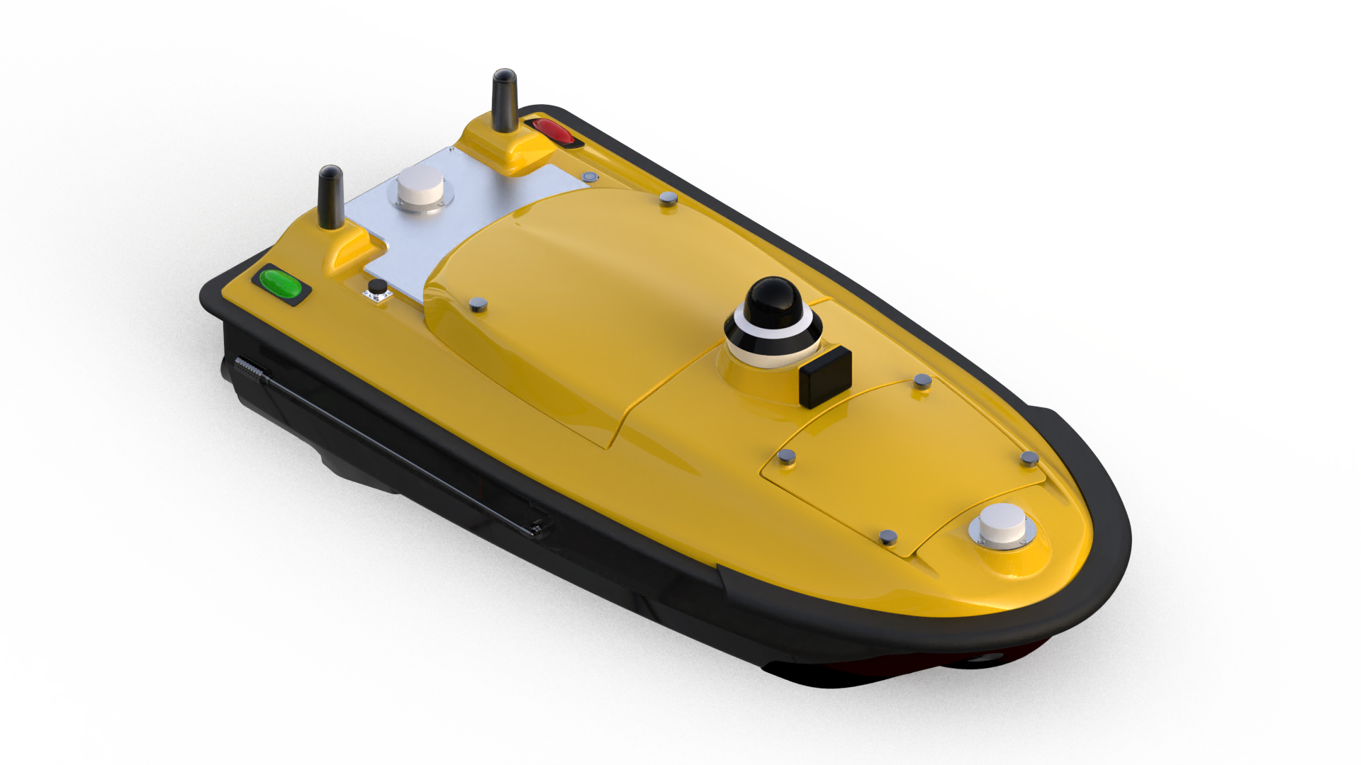
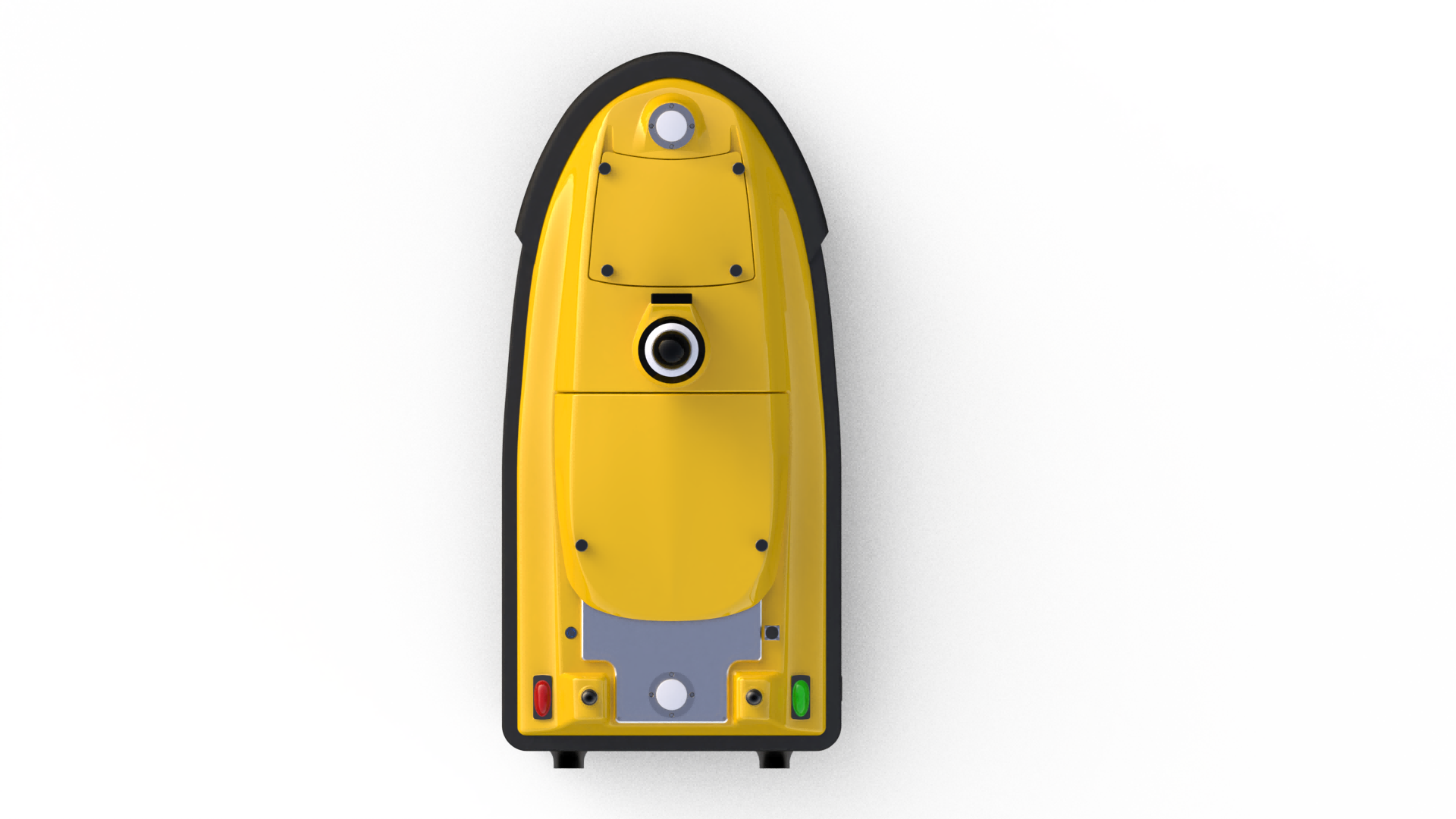
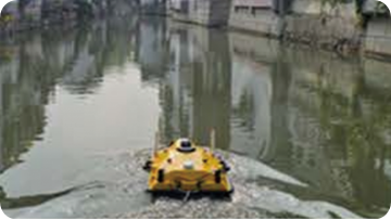
SPCraft6 is a professional-grade unmanned surface vessel (USV) developed by Guangzhou Spherefix Navigation Technology Co., Ltd. Featuring a 1.3-meter high-strength composite hull, it delivers excellent payload capacity and stability, supporting simultaneous integration of multibeam sonar, ADCP, water-quality sensors, and other large-scale instruments—serving as a mobile waterborne laboratory. Powered by the self-developed iSail intelligent control platform, SPCraft6 enables end-to-end workflows from mission planning and autonomous operation to data processing, making it ideal for hydrographic surveying, hydrological research, environmental monitoring, and search-and-rescue missions.
Spcraft6 Unmanned Surface Vesselusv Key Characteristics

Multi-Layer Intelligent Safety & Protection

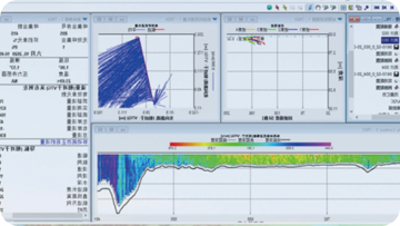
Intelligent Data Platform

Advanced Sensor Integration & Expandability

Long Endurance & High-Reliability Hardware
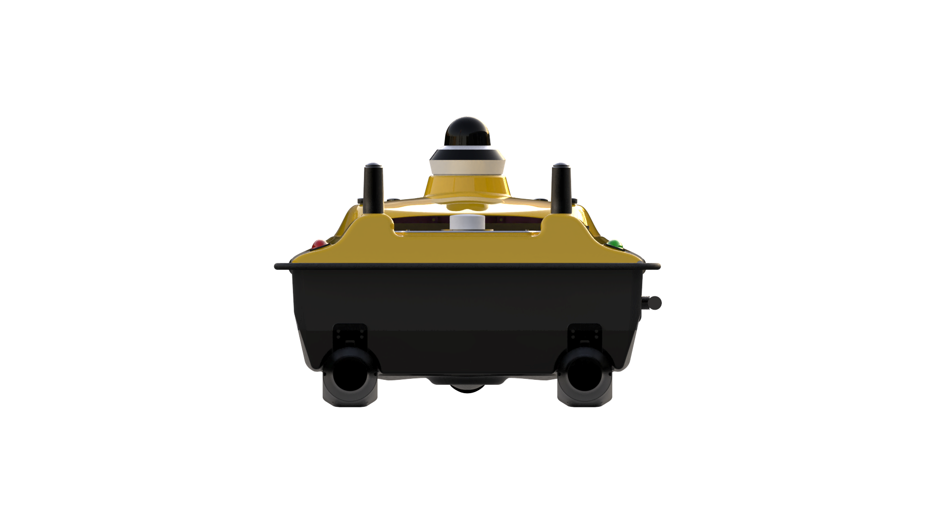
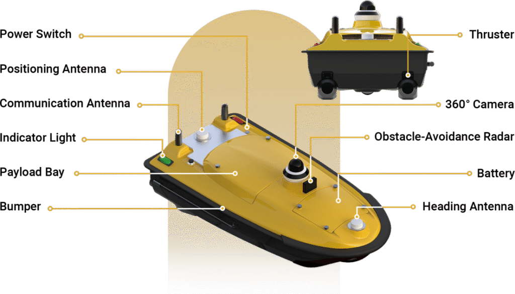
SYSTEM COMPOSITION
Spcraft6 Unmanned Surface Vesselusv Additional Features
")
Achieves ±8 mm accuracy with multi-constellation support.
Features dual-antenna GNSS and attitude sensors for reliable performance.
")
Easy-Maintenance Design: Plug-in propulsion and hot-swappable batteries.
Portable & Powerful: 12 kg lightweight structure with 50 kg payload capacity.
")
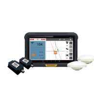
12″ Touch Terminal: Bright display, ��hour battery with fast charge.
Physical Controls: Buttons, dual joysticks, camera wheel.

Versatile Connectivity: 4G/2.4G/UHF with manual/auto/hover/tracking modes.
Smart Management: Built-in diagnostics and alerts for automated oversight.
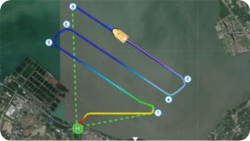
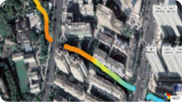
APPLICATION SCENARIO
Water Depth Measurement
Water Quality Sampling
Water Quality Monitoring
Surface Inspection
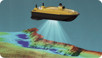
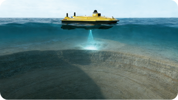
Underwater Surveying
")
")