@4x-1-scaled-120x22.png)

Dead reckoning navigation estimates a vehicle’s current position from a known starting point, a direction of travel, and distance or speed. It is useful when satellite signals are weak, blocked, or temporarily unavailable—but it is not a replacement for a verified GNSS position.
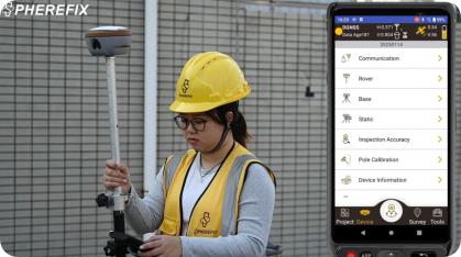
For survey, mapping, robotics, and mobile-data-collection teams, the practical question is not simply what is dead reckoning? It is how GPS/GNSS, inertial sensors, and vehicle motion data should work together without overstating accuracy.
What is dead reckoning navigation?
At its simplest, a dead-reckoning system takes the last trusted position and projects it forward. It needs three inputs:
- A starting position
- Heading or direction
- Travel distance, speed, or motion over time
If the inputs remain correct, the calculated path will remain close to the actual path. In the real world, every small error in heading, speed, wheel scale, or sensor bias accumulates. That accumulated error is usually called drift.
Dead reckoning navigation is therefore best understood as a continuity method. It fills short interruptions between absolute position updates. It should not be treated as an independent source of survey-grade coordinates.
Where GPS/GNSS fits into a dead-reckoning system
GPS and multi-constellation GNSS provide absolute position measurements. A dead-reckoning engine uses those measurements to establish or correct its estimate.
In a typical GNSS-with-dead-reckoning workflow:
- GNSS provides a trusted position when satellite conditions are good.
- An IMU, wheel encoder, compass, visual sensor, or other motion source estimates movement during an interruption.
- When GNSS recovers, the system compares the estimate with the new satellite position and corrects drift.
This combination can make navigation more continuous near buildings, tree cover, tunnels, loading bays, or other difficult environments. The result still depends on sensor quality, calibration, installation, vehicle dynamics, and the length of the outage.
For a neutral explanation of why signal blockage, satellite geometry, and receiver design affect GPS accuracy, read the GPS.gov accuracy guidance.
GPS dead reckoning and GNSS dead reckoning are not the same as RTK
These terms are often used together, but they solve different problems.
| Method | Primary job | Main limitation |
|---|---|---|
| Dead reckoning | Estimate motion between known positions | Drift increases without correction |
| GPS/GNSS positioning | Provide absolute satellite-based position | Availability and quality change by environment |
| RTK GNSS | Improve real-time relative positioning using corrections | Needs a valid correction workflow and suitable conditions |
| GNSS + IMU/odometry | Maintain a navigation estimate through brief GNSS gaps | Requires sensor integration and validation |
For a field crew, RTK GNSS remains the measurement reference when the job requires repeatable, high-precision positioning. Dead reckoning can support continuity, but it does not remove the need to check fix status, correction age, antenna setup, coordinate settings, and field control.
Four factors that determine whether a dead-reckoning estimate is usable
1. The quality of the last GNSS position
Dead reckoning starts from the last accepted position. If the system begins with a poor GNSS solution, an estimate can look continuous while being wrong from the first second. Define the conditions under which the system may initialize or re-initialize its position.
2. Heading and sensor alignment
Small heading errors cause large lateral errors over distance. Sensor orientation, antenna-to-IMU offsets, wheel scale, and mounting rigidity all need to match the vehicle and use case. A sensor that is accurate on a flat road may behave differently on rough terrain or a vessel.
3. Time without satellite correction
The longer the GNSS interruption, the more drift should be expected. Teams should set a practical maximum outage time and flag data collected beyond that limit for review instead of assuming the navigation trace is equally reliable everywhere.
4. The decision the position will support
A navigation estimate may be suitable for displaying a route, keeping a platform moving, or bridging a short gap in a trajectory. It may not be suitable for setting out a point, certifying a boundary, or accepting a survey measurement. Define the acceptable error before choosing the system.
A practical checklist for survey and mapping teams
Before relying on dead reckoning navigation, ask:
- What GNSS solution is used to initialize and correct the system?
- Which motion sensors contribute to the estimate, and how are they calibrated?
- How long are typical signal interruptions at the job site?
- Is the output for navigation continuity, mapping trajectory, or a measurement decision?
- What warning, quality flag, or review process applies when GNSS is unavailable?
- Has the configuration been tested in the same environment, vehicle, and speed range as the planned work?
These questions turn an attractive feature label into an operational requirement. They also help buyers compare systems on the information that affects field performance rather than on a generic “GPS dead reckoning” claim.
Choosing the right GNSS foundation
If your team’s main need is reliable field positioning, start with the GNSS and correction workflow. A suitable GNSS receiver for surveying should be selected around your environment, correction source, workflow, controller software, and required output—not around dead reckoning alone.
For automotive or tightly integrated navigation projects, GNSS, IMU, odometry, and software integration need to be assessed as one system. For standard site survey work, a clear RTK workflow and disciplined field checks are usually the first priority.
Frequently asked questions
Is dead reckoning navigation accurate enough for surveying?
No. Dead reckoning is a continuity estimate, not a substitute for a verified survey position. Check RTK fix status, correction quality, coordinate settings, and field control before accepting a measurement.
What sensors are commonly used with GNSS dead reckoning?
A GNSS receiver can be integrated with an IMU, wheel encoder, compass, visual sensor, or other motion source. The useful combination depends on the vehicle, outage duration, mounting, calibration, and the decision the position must support.
For an automotive-specific perspective, see our automotive GNSS–IMU dead-reckoning overview.
Final takeaway
Dead reckoning navigation keeps an estimate moving when an absolute GNSS update is briefly unavailable. GPS/GNSS corrects that estimate; IMUs and motion sensors help propagate it; RTK supports a separate high-precision positioning workflow. Treat each role separately, validate the system under real operating conditions, and choose equipment based on the decision your position data must support.
If you are comparing GNSS/RTK equipment for a survey or mapping workflow, contact Spherefix with your operating environment, correction source, and required accuracy. That makes it possible to discuss a suitable configuration before purchase.
Buyer checklist
Choosing a GNSS with dead reckoning for a field workflow
Dead reckoning can help maintain a position estimate during short GNSS interruptions, but it is not a substitute for verified RTK coordinates. Buyers should ask how the GNSS, IMU, correction source and vehicle or platform data work together in the intended environment.
- Confirm the interruption scenario: urban obstruction, tree cover, tunnel approach or vehicle-mounted work.
- Confirm the positioning reference and correction workflow after GNSS returns.
- Ask which functions are included in the proposed configuration rather than assuming that every IMU receiver provides dead reckoning.
SP35 is published as an RTK receiver with a tightly coupled IMU, AR stakeout and camera-assisted laser surveying. Discuss the exact continuity requirement with Spherefix before selecting it for a dead-reckoning workflow.
 English
  French
  German
  Spanish
  Arabic
  Russian
  Portuguese