





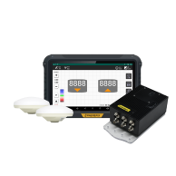
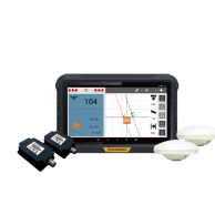
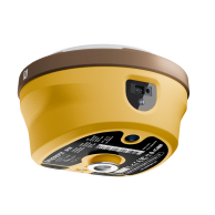
Machine universelle tout-en-un de contrôle M6

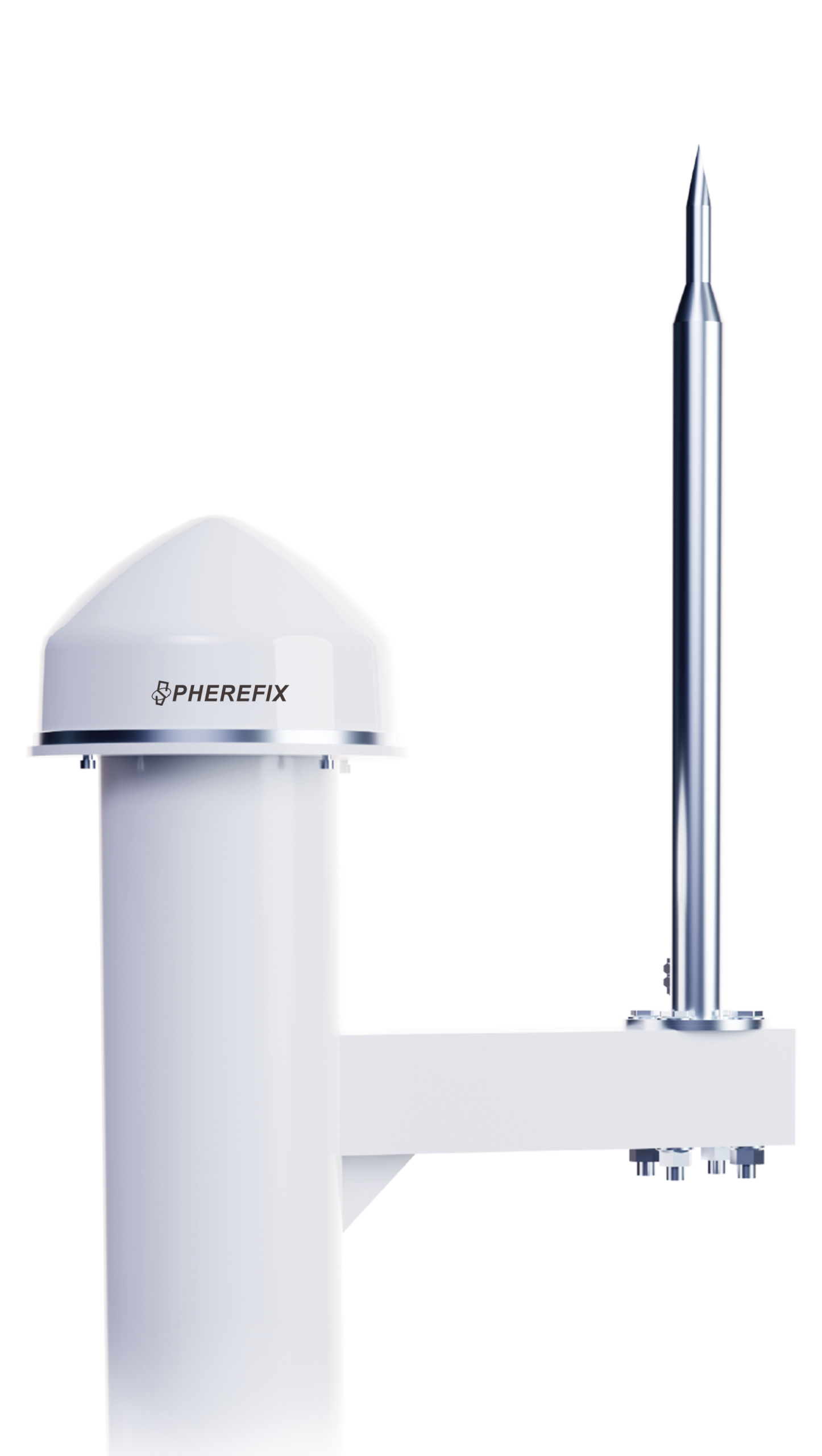
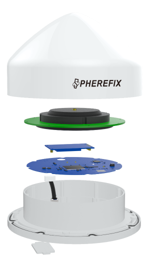
M6 RTK corrections are suitable for geological disaster monitoring and early warning. It has a built-in independent high-precision and low-power positioning module. The host adopts an integrated design, which is easy to install and maintain. The ultra-low power design reduces system configuration. Battery capacity and solar panel power requirements reduce site construction and operating costs.

CARACTÉRISTIQUES

High-precision and low-power GNSS module

High-precision and low-power GNSS module

M6 integrates a high-precision and low-power positioning module, supporting BDS B1I/B2I/B3I/B1C/B2a, GPS L1/L2/L5, GLONASS L1/L2, Galileo E1/E5a/E5b, QZSS L1/L2/L5.

High precision sensor

High precision sensor

M6 has a built-in high-precision three-axis accelerometer and barometer, combined with a newly designed fusion algorithm engine, to effectively eliminate false alarms and support mid- and long-term early warning.

Fonction de service en nuage

Fonction de service en nuage

M6 can regularly report its status such as device location, network status, signal strength, and satellite reception status, and supports the cloud platform’s operations such as restarting, setting, and upgrading remote devices.

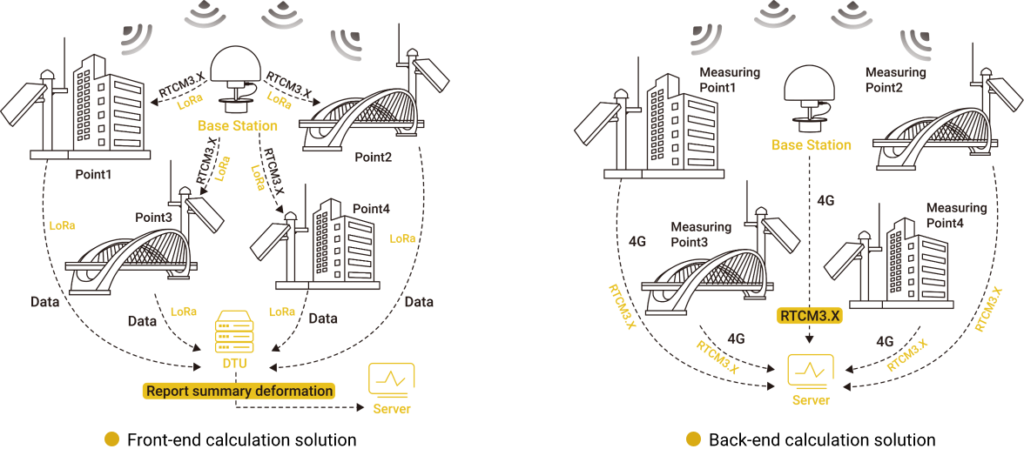
SOLUTION SCHEMATIC DIAGRAM

AUTRES CARACTÉRISTIQUES

M6其他特点图标1.png (1)

Linux + Qualcomm MDM9628
Cortex-A7 Intelligent System Platform

M6其他特点图标2.png (1)

Support 4G full Netcom
Backward compatible with 2G and 3G network

M6其他特点图标3.png (1)

Integrated design, low cost, low power consumption
Easy to install and maintain

M6其他特点图标4.png (1)

Built-in high-precision sensor
Support threshold trigger function

SYSTEM ARCHITECTURE

SCÉNARIO D'APPLICATION

Safety Monitoring of Water Conservancy Dam

Safety Monitoring of Slopes Along Highways

Bridge Structure Monitoring

GNSS

GPS

L1(C/A)/L2P(W)/L5

GLONASS

G1/G2

BDS

B1I, B2I, B3I, B1C, B2a

GALILEO

E1, E5a, E5b

QZSS

L1, L2, L5

Data format

NMEA-0183

Correction I/O

RTCM3.X

Fixed convergence time

≤10s

POSITIONING ACCURACY

Single(RMS)

Horizontal: 1.5m Vertical: 2.5m

RTK(RMS)

Horizontal: ±(8mm+1ppm) Vertical: ±(15mm+1ppm)

Static Accuracy(RMS)

Horizontal: ±(2.5mm+0.5ppm); Vertical: ±(5mm+0.5ppm)

ACCELERATION MEASUREMENT

Plage de mesure

±6g

Measuring Accuracy

±1mg

Sampling Interval

0s~24h

Upload Interval

0s~72h

INCLINATION MEASUREMENT

Plage de mesure

±90°

Measuring Accuracy

±1°

Sampling Interval

0s~24h

Upload Interval

0s~72h

SYSTEM PLATFORM

Bluetooth

V2.1+EDR/V4.0 dual mode

WIFI

802.11 b/g/n

Réseau

FULL NETCOM LTE FDD: B1/2/3/4/5/7/8/12/13/18/19/20/25/26/28 LTE TDD: B38/39/40/41 WCDMA: B1/2/4/5/6/8/19 GSM: B2/3/5/8

Lora Spread Spectrum Wireless Transmission

Frequency: 410.125~493.125MHz Transmit Power:30dBm Communication Distance:10km (open conditions)

Stockage

32GB

SIM

External SIM, FULL NETCOM

Custom Working Mode

Automatic Adjustment & Manual Adjustment

INDICATOR

Power Indicator

Lights up when powered on

Base Station Indicator

The base station starts up normally - always on

Rover Station Indicator

Fixed solution - always on Singlepoint/Differential /Floating point solution-flashing

SD Data Indicator

In the state of storing data, it flashes once every time 4K is written

ELECTRICAL CHARACTERISTIC

Tension d'entrée

9~36VDC

Consommation électrique

1.8W

Interface

RS232*1RS485*1

ENVIRONNEMENT

Température de fonctionnement

-40℃~+85℃

Température de stockage

-40℃~+85℃

Anti-seismic Grade

IEC60068-2-6

Protection de l'environnement

IP68

PHYSIQUE

Matériau

PC + ABS + Aluminum Alloy

Dimension

Φ213*136(mm)

Poids

≤2100g

Texte détaillé

M6 Universal Monitoring All-in-one Machine.pdf

SPCraft6 Unmanned surface vessel(USV) User Guide.pdf (en anglais)